
The Resource
Mapping the Hot Water Reservoir
These conceptual models help identify the most promising drilling targets and reduce resource uncertainty. This work completes the Phase 1 pre-feasibility resource modeling and characterization effort.
All modeling for this project was completed by Emilie Gentry at Teverra using Seequent’s Leapfrog software.
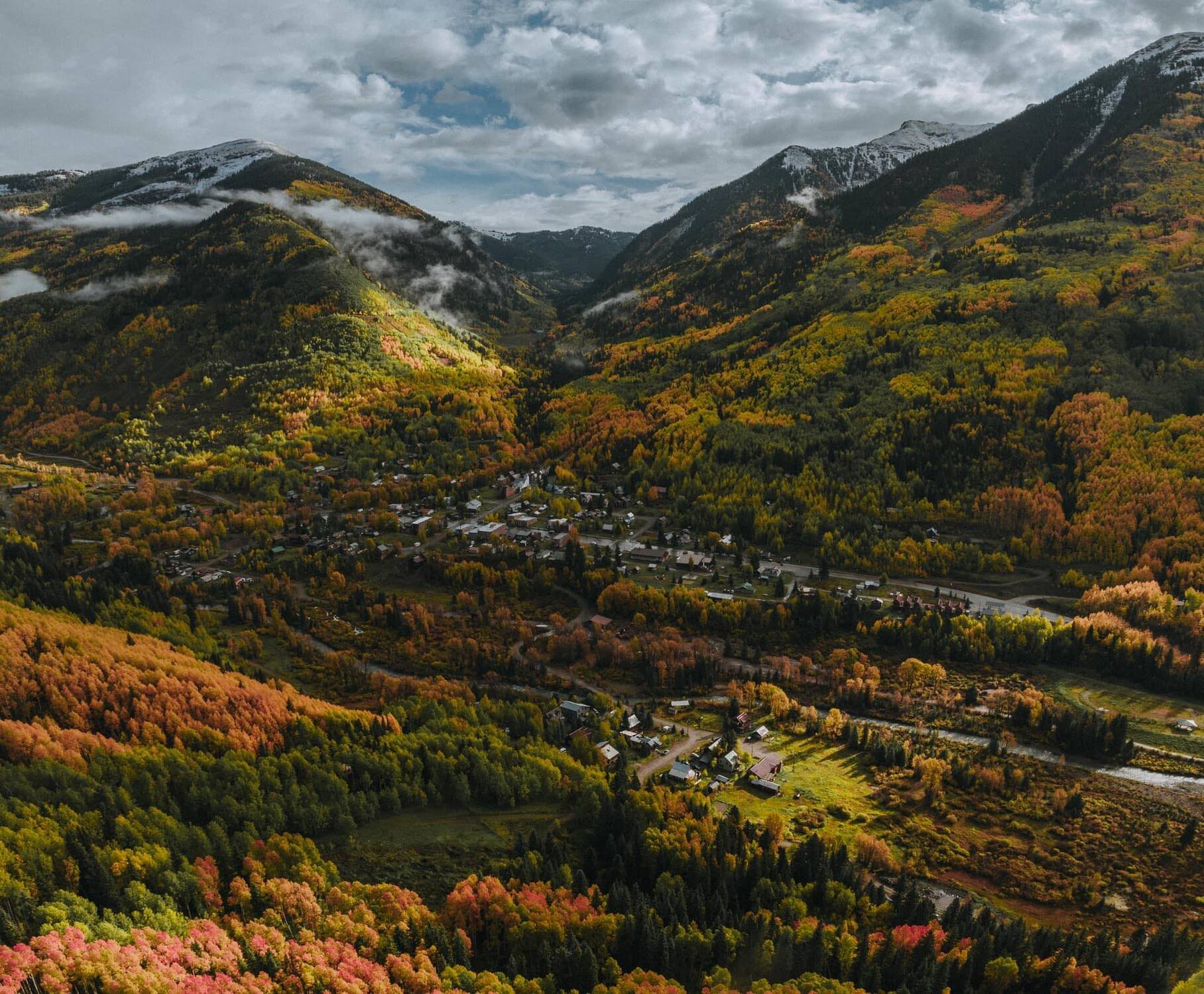
Phase 1 Update: Rico, Colorado, Naturally Augmented Thermal Energy Network


Building the 3D Geologic Framework for Rico
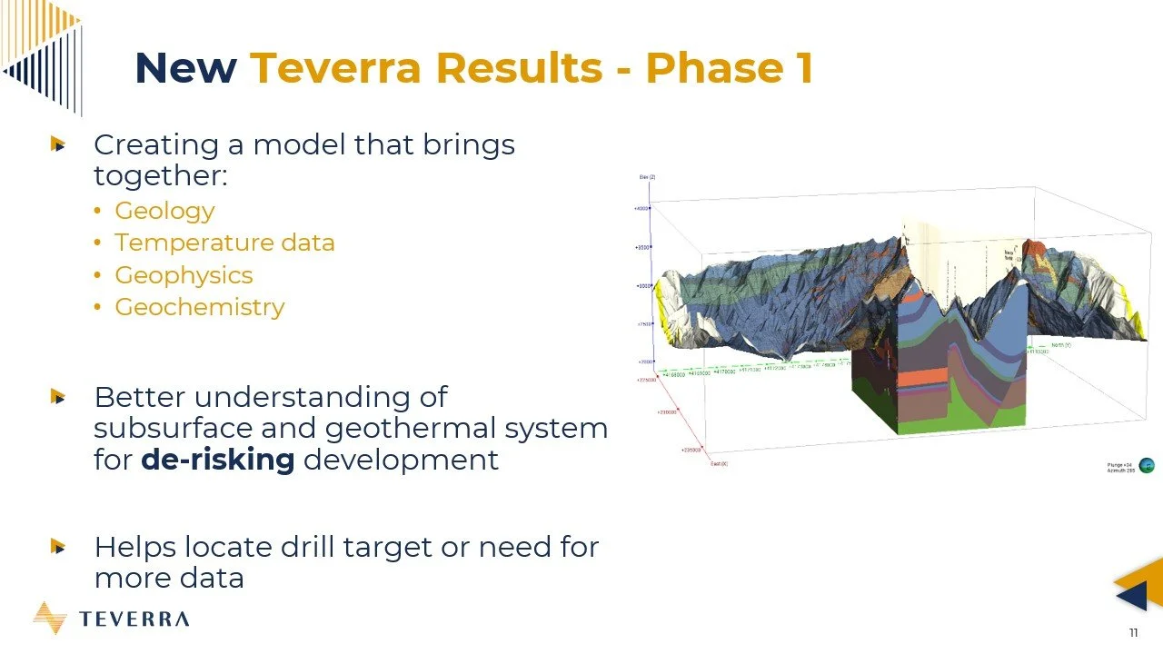
In Phase 1 of the Colorado Energy Office’s geothermal grant program, Teverra compiled all existing geologic, geophysical, and thermal data to build a comprehensive 3D model of the Rico geothermal system. This model serves as a pre-feasibility study to better understand the geothermal resource and reservoir.
3D modeling allows scientists to integrate multiple 2D datasets into one coherent picture. This improves resource estimates, reduces development risk, tests geological hypotheses, and supports future drilling and field planning.
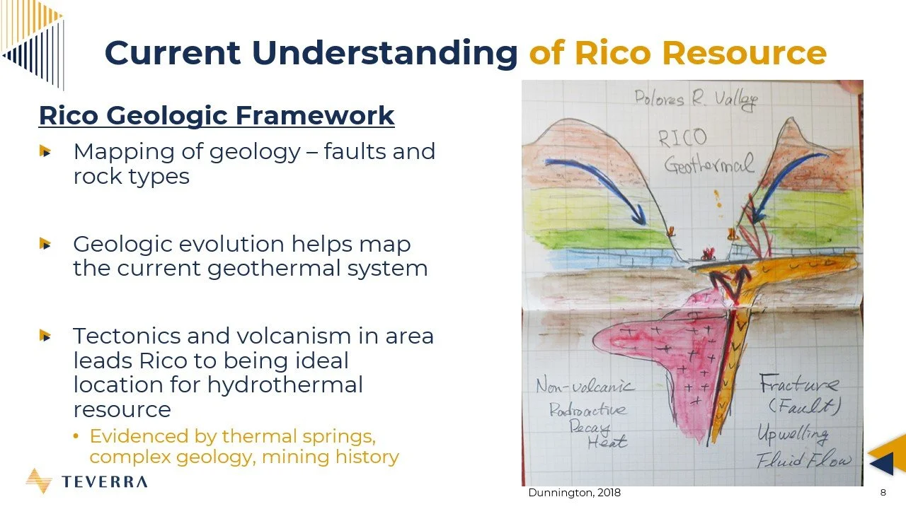
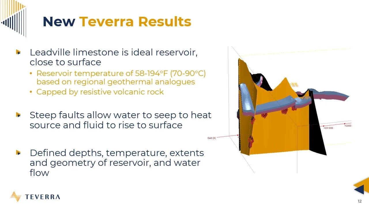
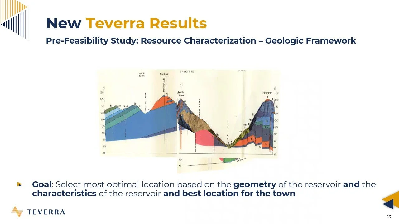
For the Rico project, the model began with a geologic map and published cross sections. From these, Teverra constructed a 3D geologic framework that includes major faults and rock formations. Rico’s tectonic and volcanic history has created a structurally complex subsurface — and that complexity is the reason geothermal fluids reach the near-surface today.
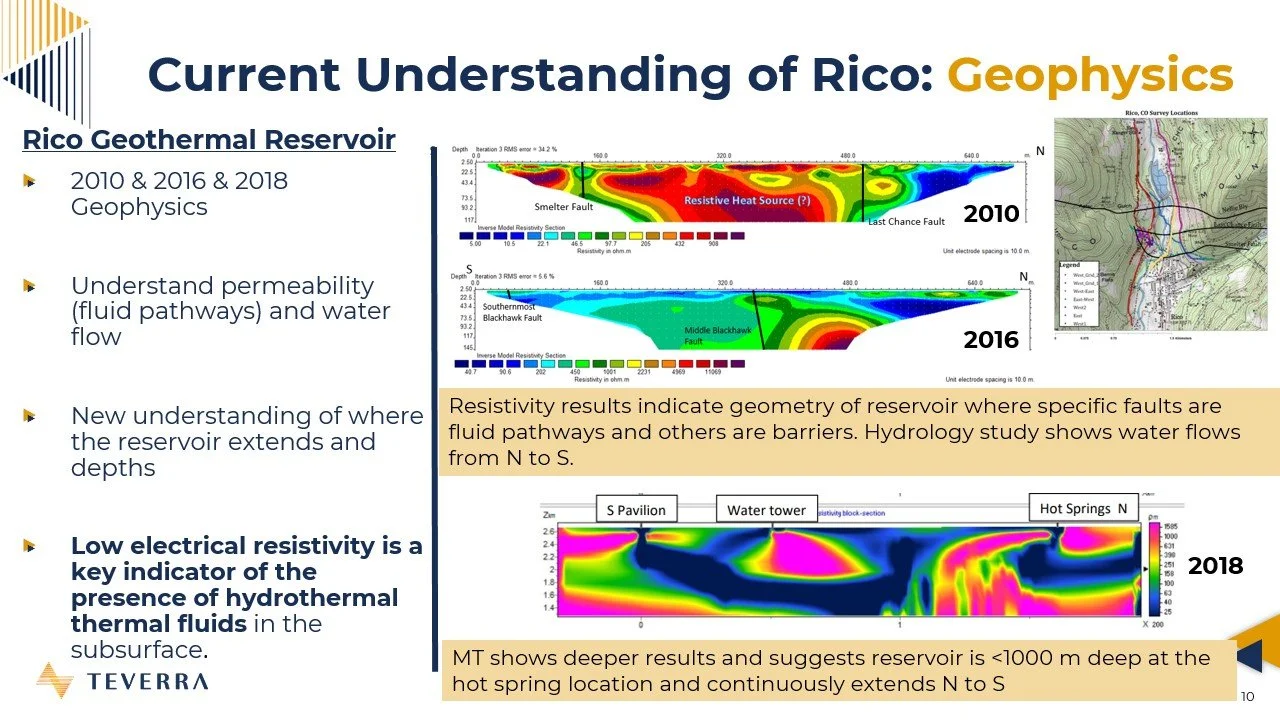
Once the structural framework was in place, geophysical datasets—including electrical resistivity tomography and magnetotellurics (collected by Colorado School of Mines between 2010 and 2018)—were integrated. These data help refine fault locations, map subsurface formations, and identify where hydrothermal fluids may exist. Low resistivity zones in particular are strong indicators of geothermal fluids. The model was validated and updated based on this geophysical information.
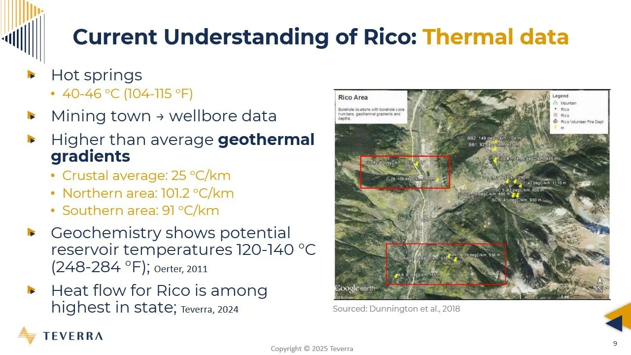
By slicing through the 3D model, we can examine the subsurface below Rico and the Rico hot springs to understand fault interactions, geologic controls on fluid flow, and how the broader geothermal system behaves. Thermal data—including borehole records from the 1980s and temperature measurements from surface springs—were then incorporated. This work helps highlight the Leadville Limestone as a key geothermal reservoir unit.
With this geologic framework established, the next step is to model the thermal properties of the reservoir and understand how all components of the system interact.
Thermal Modeling and Conceptual System Development
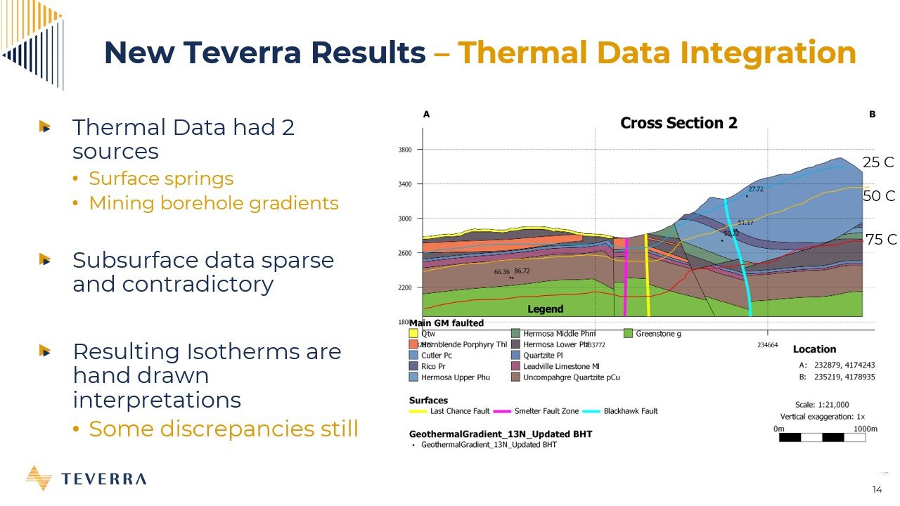
In this phase, thermal data are integrated into the geologic model to better understand the temperature structure of the Rico geothermal system. Because the available temperature data are sparse and sometimes conflicting, the thermal characterization relies on detailed geologic interpretation and a careful evaluation of available information.
Bottom-hole temperatures for historic wellbores were calculated and used as a starting point. From these data, scientists hand-drew isotherms—lines or surfaces connecting equal temperatures—to account for geological structure and reconcile inconsistencies in the dataset. These isotherms were then imported into the 3D modeling software to create temperature planes for 25°C, 50°C, and 75°C.
These surfaces allow the team to visualize temperature variation throughout the subsurface within the geologic framework, providing approximate temperature estimates for different formations. A numerical block model was also created to evaluate temperature distribution across the entire system.
Focusing on the Leadville Limestone reservoir, the model predicts temperatures of approximately 40–48°C beneath the Rico hot springs based on the integrated data and interpretations.
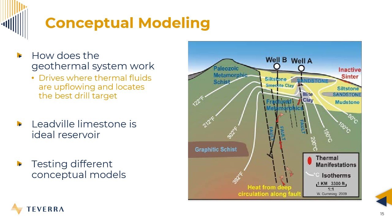
By combining all geologic, geophysical, and thermal components, a conceptual geothermal system model was developed. Two working concepts emerged:
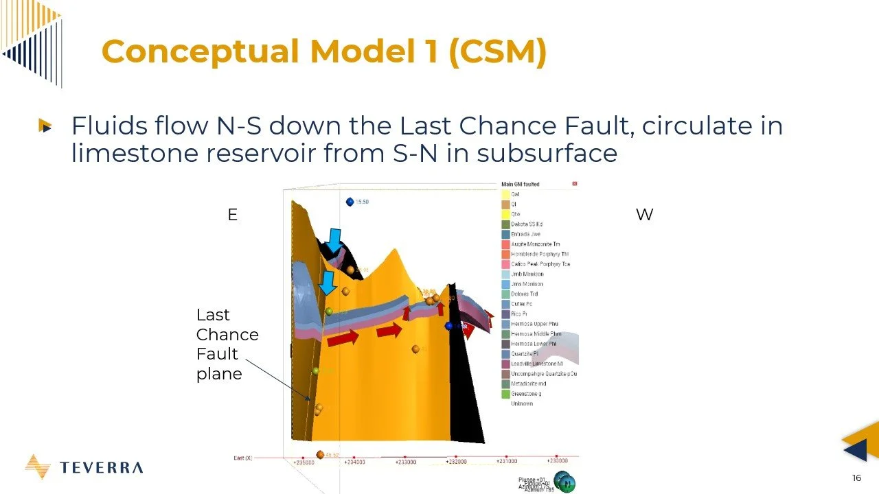
Single-fault circulation model: Fluids descend along the Last Chance Fault where they circulate at depth. (Developed by Colorado School of Mines)
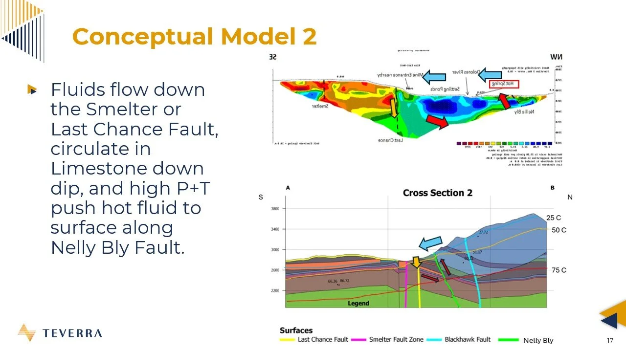
Two-fault reservoir model: Fluids descend through the Last Chance Fault, enter the permeable Leadville Limestone where they flow down-dip and heat with depth, then rise along the Nellie Bly Fault to feed the Rico hot springs.